
How Wind Gusts Affect Tower Inspection Drones Differently Than Mapping Drones

Every drone has a published maximum wind speed rating. Most commercial UAS operators know their aircraft’s number. What the spec sheet doesn’t tell you is how gusts behave near a tower structure, or why a 40-mph gust at a mapping site and a 40-mph gust at a 200-foot tower are not the same operational problem.

Understanding the difference is one of those things that separates pilots who’ve done tower inspection work from pilots who are planning to.

Why Tower Inspection Is Different

A mapping mission is typically conducted at altitude, in open air, away from significant vertical obstructions. Wind is a factor — it affects image overlap, ground speed, and flight efficiency — but the drone is operating in relatively undisturbed airflow.

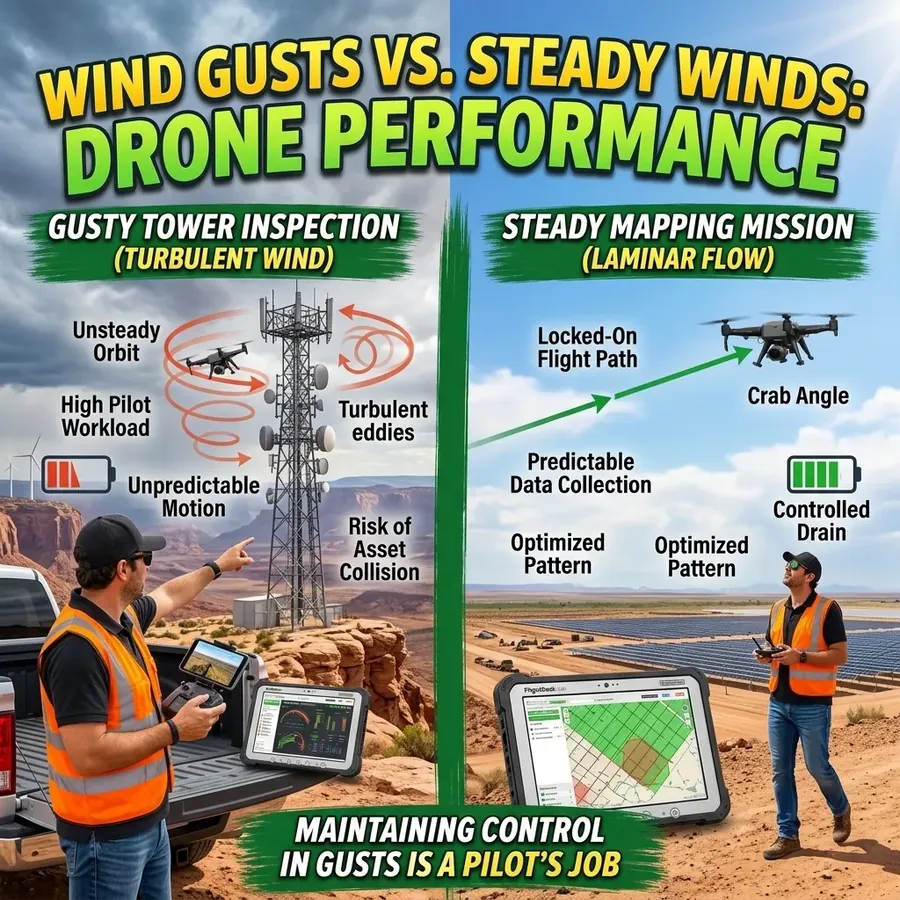
Tower inspection is different in almost every respect. You’re flying within feet of a large vertical structure at varying altitudes, often in a tight orbit. The structure itself disturbs the airflow. Wind that hits the tower face creates turbulence on the lee side, vortices off the edges, and unpredictable pressure gradients around antennas, platforms, and equipment clusters. A steady 18-mph wind becomes a 35-mph gust on the downwind side of the tower, then a sharp direction change as you round the corner.

The drone’s flight controller compensates for this continuously, but compensation has limits. The closer you are to the structure, the faster a loss of position control becomes a collision.

The Gust Problem Specifically

Steady wind is manageable. Gusts are the real variable. A gust is a rapid, brief increase in wind speed above the sustained baseline — and its effect on a drone depends on where the aircraft is in its orbit when the gust arrives.

On a mapping mission, a gust pushes the drone off its planned line and the flight controller corrects. The consequence is a minor deviation in coverage or an image taken a fraction of a second late. On a tower inspection mission, the same gust arriving when the drone is three feet from the antenna face has a different consequence.

The practical implication: your go/no-go wind threshold for tower inspection work should be more conservative than for mapping work, and it should be driven by the gust speed as much as the sustained speed. A 20-mph sustained wind with gusts to 30 mph is a different risk profile than 18 mph sustained with gusts to 35 mph — and the sustained number is the one that appears in weather apps.

FlightDeck records both sustained wind speed and gust speed for every remaining site during the weather update. Looking at the gust column before planning the next day’s tower work gives you the picture that the sustained-only forecast misses.

Structural Geometry Matters

Lattice towers — the classic steel framework structures — are more turbulent than monopoles. The open geometry creates complex vortex shedding patterns as wind passes through the structure. Monopoles and guyed towers with solid or semi-solid profiles shed wind differently. Rooftop installations add the building’s own wake and channeling effects.

There’s no single threshold that applies across all structure types. The best calibration comes from time on different structures in varying conditions — building an experiential sense of how each geometry behaves before pushing to the structural limits of the operation.

When to Call It

The honest answer on wind limits for tower inspection is that the published aircraft rating is a maximum, not a target. Most experienced tower inspection pilots operate with an effective personal limit considerably below the aircraft maximum, and they set that limit based on gust speed, not sustained speed.

If conditions are at or above your personal limit, the right call is usually to push the site rather than push through. A re-fly is inconvenient. A collision with the structure or a loss of control event is something else entirely.

The weather data in FlightDeck gives you the wind and gust picture at each site before you make the drive. That’s the decision point where conservative judgment costs you an hour of planning and saves you a great deal more.

Night Time UAS Operations Under Part 107: Rules, Requirements, and Real-World Tips

Night UAS operations under Part 107 changed significantly with the FAA’s 2021 regulatory update. What previously required a specific waiver is now permitted for certificated Part 107 pilots — but with requirements that many pilots still don’t fully understand or consistently meet. Flying at night without complying with those requirements isn’t just a legal risk; it’s a genuine safety risk in an environment where your visual reference margin is already reduced.

Here’s the complete practical guide to night UAS operations under Part 107.

What Changed in 2021

Prior to the 2021 rule update, night operations required a Part 107 waiver — a lengthy application process with no guarantee of approval. The update removed the waiver requirement for night operations, replacing it with a mandatory equipment requirement and recurrent training obligation.

Night operations are now permitted for Part 107 pilots who:

  • Have completed the updated recurrent knowledge test (which covers night operations content)
  • Have an aircraft equipped with anti-collision lighting visible for at least 3 statute miles
  • Comply with all other applicable Part 107 requirements including airspace authorization

When Does “Night” Begin?

Under Part 107, night is defined as the period between the end of evening civil twilight and the beginning of morning civil twilight. Civil twilight ends 30 minutes after official sunset at your location. This is not the same as full dark — it’s when the sun is 6 degrees below the horizon and ambient light has dropped to a defined threshold.

This matters because civil twilight varies by location and date. On a summer evening in Alaska, civil twilight ends very late. In December in the southern states, it ends earlier. Always calculate civil twilight for your specific location and date, not a general approximation.

Anti-Collision Lighting Requirements

The anti-collision lighting requirement is specific: the light must be visible for at least 3 statute miles. This is a distance requirement, not a brightness specification. The practical implication is that not all factory-installed lighting on consumer and prosumer drones meets this threshold — particularly older platforms designed before the rule change.

Verify that your specific aircraft’s lighting configuration meets the 3-mile visibility standard. If it doesn’t, aftermarket anti-collision lighting solutions are available for most platforms. This is not optional — operating at night without compliant lighting is a violation regardless of how visible you think the aircraft is.

The lighting must also function properly. Pre-flight verification of anti-collision light operation should be part of your night operations checklist, not assumed.

Airspace Authorization Still Required

Night operations do not change airspace requirements. If your planned operation is in controlled airspace, you still need LAANC authorization or a COA. Many pilots conflate the waiver removal with a general relaxation of night rules — it isn’t. Airspace authorization is independent of the time-of-day operating rules.

Practical Night Operations Safety

Site survey during daylight. Always survey your operating area before the light drops. Hazards visible in daylight — wires, antennas, trees — may be invisible at night even with good ambient lighting. Know your environment before you need to navigate it in reduced visibility.

Fly conservatively at reduced speed. Your reaction time to emerging hazards is reduced at night. Obstacle avoidance systems on many platforms are camera-based and perform poorly or are disabled in low light. Fly slower, with wider margins, than you would in daylight.

Orientation awareness. Maintaining visual orientation of an aircraft at night is cognitively more demanding than in daylight. Know your aircraft’s lighting orientation — which lights are on the front, which are on the rear — so you can read attitude and heading from the lights alone. Practice this in a controlled environment before a client job.

Battery temperature. Cooler night air affects LiPo performance, particularly in late summer and fall when temperatures drop significantly after sunset. Use fresh, warm batteries and plan for reduced flight times compared to your daytime performance baseline.

Ground lighting. Mark your launch and landing zone with ground lighting visible from operating altitude. This gives you a positional reference and makes safe landing execution faster and more reliable in the dark.

Logging Night Operations

Night operations should be logged distinctly in your flight records — noting civil twilight time, lighting configuration confirmed, and any conditions specific to the night environment. This documentation supports your operational history for waiver applications (if you pursue BVLOS or other advanced operations) and demonstrates professionalism to enterprise clients who review your safety records.

FlightDeck captures the full pre-flight and post-flight record for every mission, with fields for conditions, notes, and authorization status — building the structured night operations log that matters when clients ask about your experience.

Download the free 30-day trial and start logging your night operations with the same professional standard you apply to every other mission in your portfolio.

4th of July & the 250th: What Drone Pilots Need to Know Before Flying at Dusk

July 4, 2026 isn’t just Independence Day — it’s the 250th anniversary of the United States. The Semiquincentennial. Every major city, countless small towns, and millions of people will be outside, looking up, celebrating with fireworks displays, parades, and public gatherings unlike anything seen in recent memory.

For commercial and recreational drone pilots, this creates one of the most complex and restricted flying environments of the entire year. Here’s everything you need to know before you even think about launching on or around July 4th.

TFRs Will Be Everywhere — and They’ll Change Right Up Until Launch

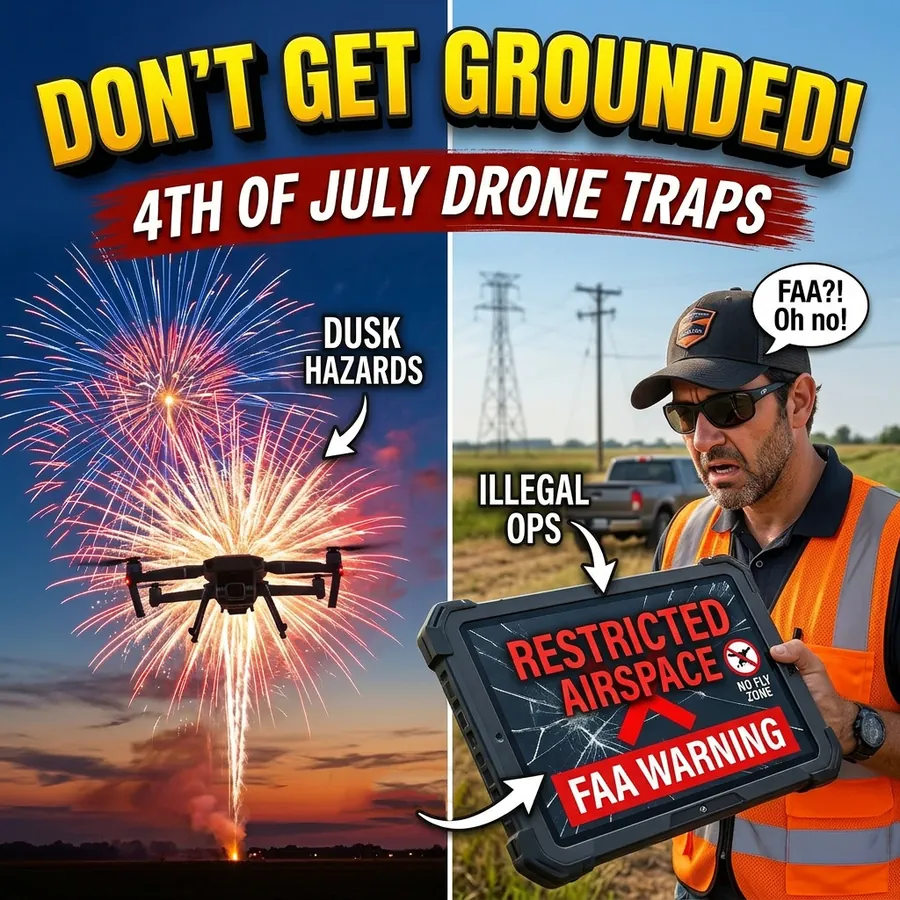
Temporary Flight Restrictions around fireworks displays and major public gatherings are standard FAA practice on July 4th. In a typical year, TFRs cover dozens of major display sites. For the 250th, expect significantly broader coverage, including:

  • Pyrotechnic TFRs extending to 3 nautical miles radius and 3,000 ft AGL around major displays
  • Security TFRs around presidential and governmental events that may cover entire metro areas
  • Stadium and venue TFRs for large organized celebrations
  • Temporary no-drone zones in high-traffic public areas issued by local authorities

The critical issue: TFRs for July 4th events are often not published until a day or two beforehand, and they frequently update or expand right up to the event. A site that was clear when you checked Monday may have a TFR by Wednesday afternoon.

This is exactly why FlightDeck’s live TFR checking tool matters. It monitors every site in your project queue against active TFRs in real time and alerts you when a TFR overlaps any of your planned sites — including new TFRs issued after your last manual check.

Dusk Operations: The Light You’re Planning For Isn’t the Light You’ll Have

Most photographers and videographers want to fly at dusk on July 4th — the golden hour before dark, catching fireworks launches against a deepening sky. This creates specific operational challenges that are different from either daytime or full night operations.

Civil twilight vs. legal night. Under Part 107, night operations require either a waiver (under older rules) or compliance with the anti-collision lighting requirements that took effect after the 2021 rule update. Civil twilight — the period from sunset until 30 minutes after — is defined as the beginning of night for Part 107 purposes. You need to know exactly when civil twilight begins at your specific location and plan accordingly.

Visual acuity degrades faster than you expect. Your eyes adapt slowly to changing light. At dusk, the transition from “I can see fine” to “I can’t clearly determine orientation” happens faster than pilots anticipate. Know your aircraft’s lighting configuration and whether it meets the 3-statute-mile visibility requirement for night ops before the light drops.

Battery performance at night. Summer evenings can be warm, which helps battery performance, but if temperatures drop after sunset, expect reduced flight times. Plan conservative battery margins for dusk operations where a landing in reduced visibility takes longer to execute safely.

Crowd Density and the Operations Over People Rules

July 4th gatherings involve dense crowds — exactly the scenario that Part 107’s operations over people rules are designed to address. Unless you have the specific approvals for Category 2, 3, or 4 operations over people with appropriate aircraft certification, flying over or directly above crowds is prohibited.

For commercial operators with a legitimate mission adjacent to a 4th of July event, the crowd consideration requires careful site planning. Know where the crowd is, know its boundary, and maintain your operational footprint clear of it. Have an abort plan that accounts for crowd movement if people shift toward your operating area.

Local Restrictions Beyond Part 107

Many jurisdictions have local drone ordinances that add restrictions beyond federal rules, and local authorities often issue special event restrictions for major public gatherings. These may not appear in FAA systems. Check your local city and county regulations, and if flying near any permitted event, verify directly with the event organizer and local authority whether drone operations are permitted.

The 250th Anniversary Commercial Opportunity

For commercial UAS pilots with the right authorizations and a professional operation, the 250th anniversary is a genuine content opportunity. Municipal clients, media companies, event organizers, and tourism boards are commissioning aerial coverage of Semiquincentennial events nationwide. If you want to pursue this work, the time to get your authorizations, permits, and client agreements in place is now — not July 2nd.

FlightDeck’s Airspace Checker analyzes your specific site against the full FAA airspace database, identifies LAANC eligibility, and generates the authorization path documentation you need to support a client engagement or permit application. The Compliance Manager generates COA narrative content for controlled airspace operations that can’t use LAANC.

Download the free 30-day trial and have your airspace analysis and TFR monitoring running before July 1st. The 250th is a once-in-a-lifetime event — be the operator who was prepared for it.

Using 5-Day Forecasts to Schedule Multi-Day Drone Campaigns

Scheduling a multi-day UAS campaign around weather isn’t just a forecasting problem — it’s a resource allocation problem. You have a finite number of flying days, sites spread across a geographic area, some with time-sensitive authorizations, and weather that doesn’t care about your project deadline.

The operators who manage this well aren’t just checking whether tomorrow looks good. They’re looking at the next five days across the full project scope and sequencing work to stay ahead of conditions.

Weather at Every Site, Not Just the Next One

FlightDeck pulls a 5-day weather forecast for every remaining unflown site in your project during the 3-Phase Update. That’s not a regional summary — it’s site-specific data pulled by GPS coordinates for each location.

What gets recorded for each site: current temperature in Fahrenheit, wind speed and gust in mph, wind direction as a cardinal bearing, cloud cover percentage, visibility, probability of precipitation, and rain or snow accumulation values. The forecast also captures 3-hour interval data for the operational window around midday, giving you a picture of conditions during the hours you’re actually likely to be flying.

Weather data is cached with a 4-hour freshness window. If you run the update again within four hours, FlightDeck skips the weather fetch for sites that are still current — the data doesn’t get stale, and you’re not burning API calls on information you already have.

Reading the Forecast Across a Region

When you’re looking at 50 remaining sites across a 200-mile project corridor, the weather picture is often uneven. One end of the corridor might be clear for three days while the other end has persistent wind and afternoon storm risk. The FlightDeck forecast data lets you sequence work toward the favorable end while the unfavorable end improves — rather than trying to push through marginal conditions because the schedule doesn’t account for the weather gradient.

The Forecast Scheduler map displays your remaining sites as color-coded pins by airspace authorization status, with the weather and scheduling data available in each pin’s popup. Green pins are scheduled. The other colors — dark red for COA-required sites, orange for sites needing 72-hour LAANC coordination, light blue for instant LAANC, light green for Class G — tell you the authorization picture at each location so you can prioritize work that’s ready to fly and use weather windows efficiently.

When Weather Forces a Delay

Sometimes the forecast isn’t marginal — a system rolls through and a week of planned work has to slide. FlightDeck’s Weather Delay tool handles this in one step: specify the number of days to add, and every unflown site’s forecast date moves forward.

The tool automatically skips sites with active LAANC authorizations. LAANC windows are time-bound, and blindly pushing the forecast date on an authorized site doesn’t extend the authorization — it creates a conflict. The Weather Delay tool protects those records so you can address them individually, while everything else shifts in one operation.

The Scheduling Edge

Weather-aware campaign scheduling isn’t about having better forecasts than your competitors. It’s about having the workflow to act on what the forecasts tell you — to sequence work intelligently, push delays cleanly, and show clients that schedule disruptions are being managed rather than simply absorbed.

The operators who consistently deliver projects on time in regions with volatile weather aren’t operating on luck. They’re making better daily decisions with better information.

Try FlightDeck free for 30 days.

Managing a 200-Site UAS Project Without Losing Your Mind

A 200-site tower inspection project isn’t 200 flights. It’s 200 individual planning decisions — airspace classification, authorization status, weather windows, scheduling, folder structure, data collection, upload, QC, reporting, and invoicing — multiplied by 200 and run in parallel across a project timeline that usually has a fixed end date.

The operators who manage this well aren’t necessarily smarter or more experienced. They’re using better tools for the parts that don’t require their expertise.

Starting a Large Project: Batch Import

Most large commercial UAS projects start with a client-provided spreadsheet — a list of tower locations, site IDs, and whatever project-specific fields the client includes. The column names vary by client, by carrier, by year, and by whoever built the original template.

FlightDeck normalizes this automatically. When you place your data file as UpdatedFlightData.xlsx in the data folder and run the processor, FlightDeck maps more than 50 common column name variations to its standard set. “Node” becomes Site ID. “Lat” becomes Latitude. “CDD” becomes Due Date. “Scan_Type” becomes MOP Type. Dozens of variations that would otherwise require manual column renaming are handled before the data ever enters your working file.

New entries are geocoded using their address or coordinates. Sites already in the system are updated without overwriting completed records. The merge is non-destructive.

The Progress Scoreboard

The FlightDeck dashboard shows three numbers at all times: R for remaining flights, F for flights flown and logged, and T for total historical flight records. These update automatically as flight status changes.

Each site in the project moves through six status stages: Not Scheduled (0%), Scheduled (10%), Flown (40%), Forms Needed (50%), Submitted (90%), and Complete (100%). These stages drive the progress calculation and tell you and any supervisor reviewing the project exactly where every site stands — not whether the data file was updated, but what stage of completion each site has reached.

For a 200-site project, being able to answer “how many sites are at Forms Needed stage?” or “how many are complete and invoiced?” without manually counting rows is the kind of visibility that makes a project manageable.

Folder Structure Automation

Before flying, you need a directory structure ready to receive data — a sub-folder for each site, organized consistently so photos, KML files, and reports all land in the right place. On a 200-site project, creating those folders manually is an hour of tedious work that doesn’t require your judgment.

FlightDeck’s Create Folders tool reads your site list and generates the full directory structure automatically. Every site in your project gets a folder, named exactly to match the Site ID, with all required sub-directories created. Run it once at project start, and your folder structure is ready for the entire project.

Daily Reports

The 3-Phase Update generates daily reports automatically as part of its output. Supervisors and project managers who need to know current status don’t need to interrupt your field operations to ask — the report reflects the state of the project as of the last update run, and it’s available without any manual data extraction.

The Compounding Advantage

The productivity argument for this kind of automation isn’t just time saved on individual tasks. It’s the compounding effect of not having to context-switch between flying and administrative work. Every minute spent updating a spreadsheet manually, creating folders, or chasing down a site’s authorization status is a minute not spent on the work that actually requires your expertise.

On a 200-site project, the administrative overhead is substantial. FlightDeck doesn’t eliminate all of it — there’s still judgment required at every stage. But it handles the parts that don’t require your judgment, which is most of the data management.

That’s the difference between a project that feels manageable and one that doesn’t.

Try FlightDeck free for 30 days on your next project.

Scaling Your UAS Business: From Solo Operator to Multi-Pilot Team

Two commercial drone pilots reviewing a job site map together before a multi-aircraft UAS inspection mission

The demand for commercial UAS services has outpaced the supply of organized, reliable operators in most specialized markets. Telecommunications inspection, power line survey, agricultural data collection — these markets are awarding larger contracts to operators who can demonstrate they can handle volume, consistency, and multi-site coordination at scale.

The problem is that most solo operators who try to scale hit the same wall: their operational systems — or lack thereof — don’t extend to a team. What worked for one pilot in a spreadsheet doesn’t work for four pilots across three states.

Here’s the operational infrastructure you need to build before you scale, not after.

Standardized Procedures Come First

The most common failure mode in scaling a UAS operation is adding people before adding systems. The result: every pilot does things slightly differently, data quality varies by operator, clients notice the inconsistency, and the reputation of the operation suffers from work that isn’t uniformly professional.

Before you bring on a second pilot, every core operational procedure needs to be documented, tested, and standardized. Pre-flight inspection. Site survey. Launch and recovery. Data capture. Upload and delivery. Post-flight documentation. Every step that happens on a job needs a defined standard that any qualified pilot can execute consistently.

This is your operations manual. It’s the foundation on which you build a scalable team.

Fleet Management and Equipment Tracking

A solo operation with one aircraft is relatively simple to track. A three-pilot operation with multiple aircraft, a library of batteries, and payload options by job type requires systematic fleet management.

Every aircraft needs documented maintenance history, current registration, and flight hour tracking. Every battery needs cycle count monitoring. When equipment goes out with a field team, you need to know which aircraft and which batteries went where, and what condition they came back in.

FlightDeck’s Drone Maintenance Log tracks maintenance events, battery cycles, motor hours, and repair history by serial number. Two editions are available — solo operator and fleet management — covering both stages of your operation’s growth.

Coordinating Multi-Pilot Schedules and Site Assignments

With multiple pilots, site assignment and scheduling become a coordination challenge. Who’s flying which sites on which days? Are authorization windows aligned with the pilot who’s actually going to that site? When sites get rescheduled due to weather, which pilot’s schedule is affected?

FlightDeck’s Forecast Scheduler reviews pending sites across the entire project and suggests an efficient fly schedule based on weather windows, site proximity, and project priority. Instead of manually balancing a multi-pilot calendar, you get a data-driven suggestion that accounts for conditions and location clustering.

The shared Google Maps pin layer — generated automatically by the 3-Phase Update — gives every pilot on the team a current view of project status without anyone needing to call in for a status update.

Data Consistency Across Multiple Pilots

One of the hardest quality control challenges when scaling is ensuring that data delivered by Pilot A meets the same standard as data delivered by Pilot B. Different camera settings, different flight patterns, different upload habits — all of these create inconsistency that clients notice.

FlightDeck’s QC Uploader applies the same automated EXIF quality checks regardless of which pilot captured the data. Images below F/4 aperture or above ISO 400 are flagged before upload proceeds, for every pilot on every job. The quality standard is enforced by the tool, not by trusting individual compliance.

Client Reporting at Scale

Enterprise clients on large projects want progress updates without having to ask for them. FlightDeck’s TX Daily Report generates formatted daily operations reports from the project database — publishable on a schedule, even hourly, without interrupting flight operations. Supervisors and clients see current status automatically.

The Confirm Progress dashboard gives team leads a color-coded delivery status view across every flown site: what’s been uploaded, what forms have been submitted, what’s fully complete and what’s pending. Managing a team’s delivery pipeline from one screen, without chasing individual pilots for status.

The Financial Case for Building Systems Before Scaling

Building operational infrastructure before scaling feels like overhead. It is — but it’s the overhead that determines whether scaling creates profit or just creates more problems at larger scale.

Operators with documented procedures, systematic fleet management, and consistent data delivery command premium rates from enterprise clients and win repeat contracts. Operators who scale on informal systems tend to win more work than they can execute reliably, damage client relationships, and find that growth made profitability harder, not easier.

Build the infrastructure first. Then grow into it.

Download FlightDeck free for 30 days and build the operational foundation your business needs — whether you’re flying solo today or building toward a fleet. The $250 lifetime license is the last operations software investment you’ll make.

Thunderstorm Season and Commercial Drone Ops: What the Forecast Apps Don’t Tell You

Thunderstorm season doesn’t just cancel individual flights. It scrambles project schedules across entire regions, sometimes for days at a time. A line of afternoon storms in the Gulf Coast or the Southeast can make an entire week’s worth of planned sites unflyable by early afternoon, and if you’re managing a multi-site project, the cascading schedule impact is its own problem to solve.

The apps that give you a good morning forecast — the ones that tell you whether today’s mission looks feasible — aren’t built to help you think about what to push, by how much, and which sites to protect. That’s a different problem.

The Weather Data Problem at Scale

On a single-site mission, weather is a go/no-go question. You check the forecast, you check conditions on arrival, you make a call.

On a 150-site tower inspection project, weather is a scheduling problem. You have sites in three states, some with LAANC authorizations that have fixed windows, some with COAs that have expiration dates, some with client deadlines that don’t move. When a weather system rolls through and makes a week of work unflyable, the question isn’t just “when can we fly?” — it’s “which sites do I push, by how much, and which ones do I have to protect?”

FlightDeck pulls a 5-day weather forecast for every remaining unflown site in your project from OpenWeatherMap — temperature, wind speed, gusts, wind direction, cloud cover, visibility, precipitation probability, and rain/snow accumulation. That’s not a single point check; it’s a weather picture across your entire project scope so you can see where the system is hitting hardest and plan around it.

The forecast data is cached with a 4-hour freshness window — if you run the update multiple times in a single day, FlightDeck won’t re-fetch data that’s still current, which keeps things fast and doesn’t burn through API calls unnecessarily.

The Weather Delay Tool

When a weather system forces a multi-day delay across your project, FlightDeck’s Weather Delay tool handles the rescheduling in one step. You specify the number of days to add, and FlightDeck pushes every unflown site’s forecast date forward by that amount.

The important detail: sites with LAANC authorizations on file are automatically skipped. LAANC authorization windows are time-specific — pushing a site’s forecast date forward doesn’t extend the authorization, it just creates a conflict between your schedule and your existing approval. The Weather Delay tool recognizes this and leaves LAANC-scheduled sites untouched so you can handle those manually.

Everything else — sites waiting to be scheduled, sites scheduled without LAANC — gets pushed in one operation. A week-long weather delay that would otherwise mean manually updating 80 rows takes about ten seconds.

Why “Mostly Favorable” Isn’t a Go

One of the harder lessons in commercial UAS operations is learning to be skeptical of forecasts that look mostly good. Thunderstorm season in particular produces convective activity that forms fast and moves unpredictably — a clear morning can deteriorate to dangerous conditions by early afternoon, and those conditions often develop faster than a weather app refreshes.

The practical protocol for thunderstorm season is to front-load your flying. Start earlier, plan to be wheels-down by early afternoon, and treat any forecast that shows afternoon thunderstorm probability above around 30% as a real risk to your timeline rather than a number to rationalize around.

FlightDeck’s weather forecast data gives you the picture for tomorrow’s sites before you finalize today’s plan. That’s the decision point that matters — not the morning of, when you’re already in the truck.

Managing weather delays well is one of the things that separates operators who keep projects on track from those who find themselves constantly rescheduling and explaining slippage to clients. The tools that help you do that quickly and accurately are worth having ready before the first line of storms arrives.

Photo QC and Data Delivery: Why Your Upload Process Is Costing You Clients

Flying the mission is half the job. Delivering data that meets client quality standards — every file, every time, with verified completeness — is the other half. And for many commercial UAS operators, the delivery half is where professionalism breaks down.

Blurry images passed to a client. Files missing geotag data. Incomplete uploads discovered only when the client opens the delivery. Upload interruptions on rural connections that result in partial datasets. These problems lose contracts. Here’s how to build a delivery workflow that catches problems before they reach the client.

Why Photo QC Matters More Than Pilots Think

For inspection, mapping, and data collection clients, your photos aren’t just documentation — they’re the deliverable. An image that fails to meet technical specifications doesn’t just look bad; it may be genuinely unusable for the client’s processing pipeline.

Tower inspection clients need images with sufficient depth of field to identify equipment defects. Photogrammetry clients need consistent exposure and overlap for point cloud generation. Agricultural clients need calibrated imagery for accurate NDVI analysis.

Every image that fails quality standards is a rework. Every rework is a return trip or a disputed invoice. Building QC into your workflow before upload — not after the client reviews the delivery — is the difference between a professional operation and an amateur one.

The Core Photo Quality Parameters

For most commercial UAS photography, the critical technical parameters are:

Aperture. Narrower than F/4 risks diffraction softening at common UAS camera sensor sizes. F/4 or wider is the standard for most platforms and is the threshold where image sharpness becomes reliably consistent across varied lighting.

ISO. Above ISO 400, digital noise becomes visible and may interfere with feature detection in photogrammetry and inspection analysis. ISO 100–400 is the clean window for most commercial work.

Shutter speed. Motion blur from a moving drone at the wrong shutter speed is one of the most common QC failures. Your minimum shutter speed should be fast enough to freeze drones motion at typical survey speeds.

EXIF/XMP metadata completeness. GPS coordinates, altitude, gimbal angle, and timestamp embedded in image metadata are critical for photogrammetric processing, KML generation, and data management. Files with incomplete or corrupt metadata may be rejected by client processing pipelines.

How FlightDeck’s QC Uploader Works

FlightDeck’s QC Uploader automates the quality check before any file is allowed into the upload queue. Every image in your upload folder is analyzed automatically against defined quality parameters. Images that fall outside thresholds — below F/4, above ISO 400, or with metadata issues — are flagged before upload begins. You review the flags, address the issues, and only qualified files proceed.

For survey and mapping operations using Propeller Aeropoints, the QC Uploader adds another layer: KML altitude correction using geoid undulation calculations from your ground control point data. The result is KML files where pins render at correct orthometric elevation in Google Earth — not at raw GPS altitude, which in most of North America sits above the actual ground surface.

AWS S3 Integration and Multi-Threaded Upload

For clients who receive data directly to cloud storage — increasingly common in enterprise inspection and data collection — FlightDeck connects directly to your AWS S3 bucket. Configure your credentials once and all qualified uploads go to S3 with multi-threaded processing running up to ten parallel threads.

This matters specifically for field operations on rural LTE or intermittent signal: the multi-threaded engine is built to handle interrupted connections. A SQLite manifest database tracks every file’s upload status — pending, uploading, uploaded, failed. When a connection drops, the upload resumes exactly where it left off. No duplicate uploads. No missed files. No manual retry.

Delivery Verification

After upload completes, FlightDeck runs file-size verification and completion checks to confirm every file arrived intact. A delivery that passes these checks is a delivery you can represent to your client as complete and verified — not just “I think it all went through.”

Your FlightDeck Confirm Progress dashboard shows every delivered site with color-coded status: uploaded, forms submitted, fully complete. At the end of every field day you know exactly where your project stands.

Download the free 30-day trial and build the QC and delivery workflow that keeps clients coming back because your data is always right the first time.

Nearest Airport, Nearest Hospital: The Situational Awareness Data Every Pre-Flight Needs

FlightDeck software displaying airport and hospital proximity data on a map for a commercial UAS job site

Most Part 107 pilots know their airspace classification before wheels up. Fewer know the distance and bearing to the nearest airport — or the nearest hospital. Both numbers matter, and both require more than a quick glance at a map to calculate accurately for a hundred sites at once.

FlightDeck calculates and records both automatically for every site in your project, stored directly in your working data file so the information is always there when you need it.

Why Distance to the Nearest Airport Matters

Airspace classification tells you whether you need authorization. Distance and bearing to the airport gives you the operational picture — which direction manned traffic is likely approaching from, how close you are to approach and departure corridors, and what situational awareness your crew needs during the operation.

It also matters for your documentation. COA narratives, pre-flight checklists, and formal risk assessments typically require nearest airport information. Having it automatically populated across your entire project means you’re not manually looking up each site the night before.

FlightDeck stores two entries for each site: the nearest airport and the second-nearest airport. Each entry includes the airport name, ICAO identifier, airport type, airspace class, distance in nautical miles, and cardinal bearing. All of this is calculated using Haversine geometry — the same spherical distance formula used in aviation navigation — applied against a locally stored airport database.

Why Distance to the Nearest Hospital Matters

UAS incident response planning requires knowing where the nearest medical facility is. For inspection work in rural corridors — tower lines, pipelines, agricultural parcels — that answer isn’t always obvious, and it changes with every site.

FlightDeck records the nearest hospital and second-nearest hospital for each site, with the same distance and bearing format as the airport data. On a 200-site project spread across three states, that’s 200 hospital lookups that don’t require manual research.

This data supports your pre-flight risk assessment and is available in the same row as your airspace classification, weather, and authorization status — all in one place when you’re planning the next day’s work.

How It’s Calculated

All distance and bearing calculations use Haversine geometry applied to latitude and longitude coordinates from your site list. The airport and hospital databases are stored locally, so the lookup runs whether or not you have an internet connection.

When a site already has nearest-airport data on file, FlightDeck reads from a SituationalAwareness cache to avoid redundant calculations on re-runs. New sites and any sites missing the data are calculated fresh during the 3-phase update.

The bearing is expressed as a cardinal direction — N, NE, SW, and so on — alongside the nautical mile distance, which is what you want for communicating airspace proximity in plain language.

What This Looks Like in Practice

Before a week-long tower inspection campaign, you run the FlightDeck 3-Phase Update. By the time it finishes, every site in your project has its nearest airport and hospital populated — the distance, the direction, and the identifier. Your pre-flight checklist for each site has the information without a separate research step.

When a client or project manager asks how close Site 47 is to the nearest controlled field, you have the answer in your spreadsheet, not from memory or a map lookup.

When you’re writing a COA narrative for a controlled-airspace site, the nearest airport data is already available. When you’re doing site-by-site risk assessment, hospital proximity is part of the same dataset.

The situational awareness data FlightDeck calculates is the kind of information that takes five minutes per site to look up manually — and zero minutes per site when it’s done automatically across your entire project.

FlightDeck’s situational awareness calculations are included in every license tier. Try it free for 30 days.

Reading Weather for Commercial Drone Operations: Beyond the Forecast

Commercial drone pilot reading a METAR weather report on a laptop before a UAS flight operation at a tower site

Weather cancels more commercial UAS missions than any other factor. It also causes more incidents than pilots acknowledge — because many of those incidents start with a pilot who looked at a “mostly favorable” forecast and decided to fly, only to encounter conditions in the field that the forecast didn’t predict accurately at their operating altitude and location.

Reading weather for UAS operations requires more than checking a phone app. Here’s a practical framework for commercial operators who need to make defensible, repeatable weather decisions.

What a Consumer Forecast Doesn’t Tell You

Standard weather apps report surface conditions at the nearest reporting station, which may be miles from your site and at a different elevation. They aggregate conditions over broad areas. They don’t tell you:

  • Wind speed and direction at 200, 300, or 400 ft AGL at your specific site
  • Mechanical turbulence generated by buildings, terrain, or obstacles at your operating altitude
  • Thermal activity that varies by surface type and time of day
  • Localized precipitation or fog in valleys and low-lying areas
  • Wind gradient — how speed and direction change with altitude

A ground-level reading of 8 knots can be 18 knots at 300 ft AGL in certain terrain and atmospheric conditions. Your aircraft is rated for a wind limit — but that limit applies to the wind it’s actually experiencing, not the wind at the surface a mile away.

Better Weather Sources for UAS Operations

Aviation weather services. aviationweather.gov provides METARs, TAFs, winds aloft forecasts, and PIREPs from pilots who’ve actually been in the airspace. Winds aloft forecasts (FB winds) are specifically useful for predicting conditions at UAS operating altitudes.

UAV-specific weather services. Tools like UAV Forecast, Windy, and dedicated drone weather apps aggregate multiple weather models and present them in pilot-friendly formats. FlightDeck integrates with OpenWeatherMap to pull current conditions and 5-day forecasts for every site in your project automatically.

On-site observation. Arrive early. Watch the site for 10–15 minutes before launch. Watch smoke, dust, flags, tree movement, and cloud base. The site tells you things no forecast does.

Setting Personal Minimums

Part 107 doesn’t specify weather minimums for most operations (beyond 3 SM visibility and cloud clearance requirements). That means you need to set your own. Personal minimums are specific, pre-established limits that define the conditions under which you’ll fly.

For a standard multi-rotor payload operation, a conservative personal minimums set might look like:

  • Surface wind: below 15 kts sustained, gusts below 20 kts
  • Visibility: 5 SM or greater
  • Cloud ceiling: 1,000 ft AGL minimum, 1,500 ft preferred
  • No precipitation of any type
  • Temperature: above manufacturer minimum operating temperature
  • No nearby lightning within 10 SM

These are examples. Your limits should reflect your platform’s actual tested performance, your payload, your site type, and your operational risk tolerance. Write them down. Apply them consistently. Don’t negotiate with yourself on site.

Weather Delays and Rescheduling

Professional clients understand weather holds. What they don’t understand is a pilot who didn’t communicate early. If weather is trending unfavorable, notify your client 24 hours in advance — not the morning of, and certainly not after you’ve driven to the site.

For teams managing large site lists, tracking weather across dozens of locations manually is untenable. FlightDeck’s Weather Delay Tool lets you advance all un-flown site forecast dates by a specified number of days with a single click — automatically skipping LAANC-authorized sites that have fixed authorization windows.

Every remaining site in your project gets a color-coded 5-day weather forecast automatically: green for clear, red for rain, blue for snow, gray for overcast. You see your entire project’s weather picture in one view, every morning before deployment.

Download the free 30-day trial and bring weather intelligence into your daily operations workflow.